 This is an example of a univariate choropleth map; the only measurement is of population density (people/sq. mile) in the desired area.
 Friday, August 8, 2008
Univariate choropleth
This is an example of a univariate choropleth map; the only measurement is of population density (people/sq. mile) in the desired area. Continuously variable proportional circle
 This is an example of a continuously variable proportional circle; the symbols depict the ratio of Internet Users in 2004 Europe.
http://www.geog.ucsb.edu/~jeff/gis/proportional_symbols_files/map2.jpg
Classed choropleth

This map is a classed choropleth, but it is not areally averaged or standardized in any way. The intervals are the unit being measured.
Isopleth
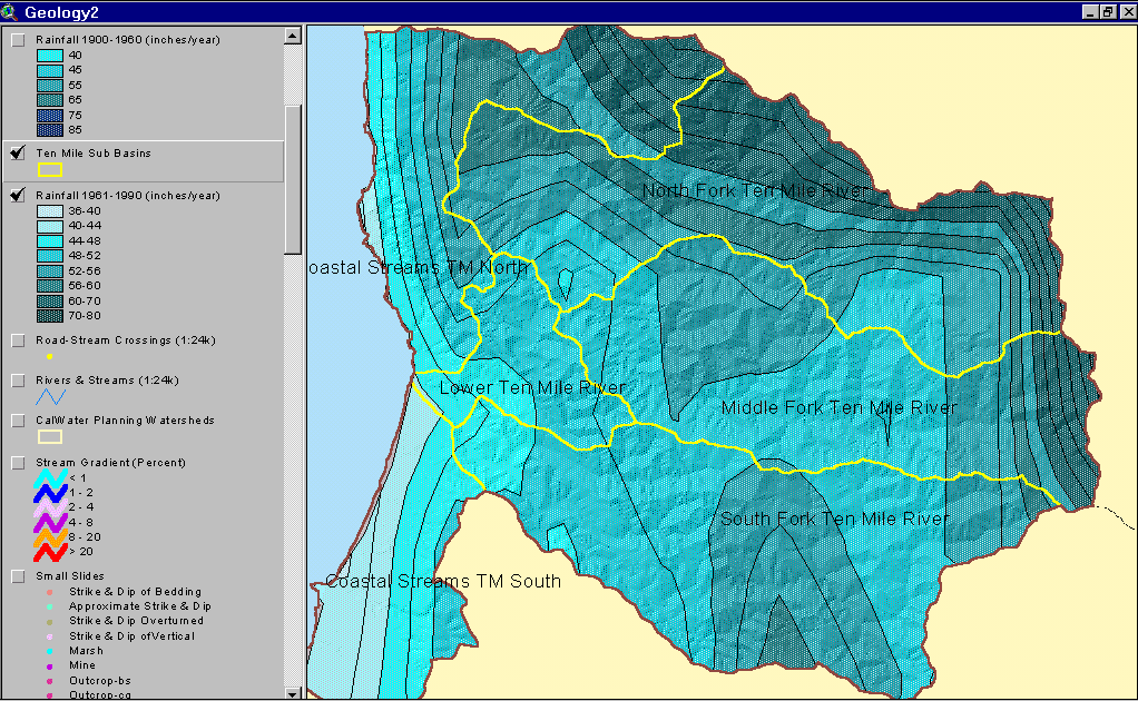 An isopleth is a feature of meteorological charts, connecting points which have an equal value of some variable at a given time and spatial area. The particular variables shown on a given chart may include values such as pressure, temperature, wind speed, etc. They are used to assist in visualizing the general features of a meteorological "field" (http://en.wikipedia.org/wiki/Isopleths)
Isohyets
 Isohyets are lines of equal precipitation, depicted in millimeters.
http://www.ecohydrology.uwa.edu.au/?f=192830
Isotachs
 This map shows isotachs, lines on a given surface connecting points with equal wind speed, together with isobars, the line of equal atmospheric pressure.
 Isobars
 Isobars are lines of equal air pressure; winds are stronger where lines are closest together.
http://z.about.com/d/german/1/0/1/J/aWetteurfronts.jpg
Subscribe to:
Posts (Atom)