Marlene's Maps

Blog Archive

  • ▼  2008 (48)
    • ▼  August (45)
      • Univariate choropleth
      • Continuously variable proportional circle
      • Classed choropleth
      • Isopleth
      • Isohyets
      • Isotachs
      • Isobars
      • Bilateral graph
      • Starplot
      • Correlation matix
      • Similarity matrix
      • Stem and leaf
      • Box plot
      • Histogram
      • Parallel coordinate graph
      • Wind rose
      • Climograph
      • Population pyramid
      • Scatter plot
      • Index value plot
      • Accumulative line graph or Lorenz curve
      • DOQQ
      • DEM
      • DLG
      • DRG
      • Statistical map
      • Cartographic animation
      • Flow map
      • Cartogram
      • Black and White aerial
      • Bivariate choropleth
      • Standardized choropleth
      • Classed choropleth
      • Dot density
      • Propaganda
      • Hypsometric
      • PLSS
      • Cadastral
      • Thematic
      • Topographic
      • Planimetric
      • LIDAR map of New Orleans Flooding
      • Doppler radar map
      • Infrared arial photo
      • Mental Maps
    • ►  June (1)
    • ►  May (2)

About Me

MH
View my complete profile

Thursday, August 7, 2008

Thematic

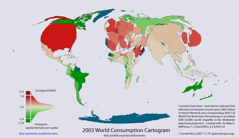
The theme of this cartographic representation is visualizing ecological footprints of nations. Red represents deficit and green represents reserve. Blue is missing data, and countries appear normal size as if in ecological balance. These type maps help gain attention to a cause by their startling expressions of differences among nations.
http://pthbb.org/natural/footprint/img/cartogram.gif
Posted by MH at 12:50 AM

No comments:

Post a Comment

Newer Post Older Post Home
Subscribe to: Post Comments (Atom)